Topographic Surveying and Aerial Inspection of Large Areas
Technological advances have been bringing countless benefits to the engineering area. The drone is one of the tools that help the work, occupying more space in the market, because of the ease of mobility and accessibility to the product.
One of the great uses of this object is the Aerial Mapping or Photogrammetry, which revolutionized the topography work. The UAVs ( Unmanned Aerial Vehicles) are capable of performing flights at low altitudes generating images that reach up to 1 cm of detail of the soil. Thus, it is possible to map an extensive area with a high level of detail in a single flight.
This method provides a wealth of detail, with agility and precision, far superior to classic topographical methods. The amount of data obtained in an aerial survey is much greater, which guarantees a more faithful representation quality of the terrain surface.
METHODOLOGY
Area Reconnaissance and Mapping
The first step to define the survey is the recognition of the area. Thus, the limits of interest of the study area are defined to determine the flight coverage, identification of control points on the ground, access routes to possible areas for equipment take-off and allocation of the geodetic GPS support base.
Based on the previous information, the points of interest are allocated on maps and plans are made to assist the location in the field with the help of the navigation GPS.
Flight Plan
At this stage, the area that will be covered by the Aerial Photogrammetry survey, previously defined, is used as the basis for planning the flight tracks (routes) that the UAV/Drone will travel to capture the images.
The flight altitude must also be considered, the GSD (Ground Sample Distance), as it will determine the accuracy and quality of the products generated, as well as the overlapping rate of the images to be captured. Thus, the more images in less time and distance travelled by the equipment, the greater the detail of the mapping.
Definition of terms: GSD and Pixel
First of all, let’s go to the meaning of the acronym: GSD stands for Ground Sample Distance. The GSD is the representation of the image pixel in terrain units (usually in cm).
In Aerial Photogrammetry, the GSD is one of the most important variables and is the first one that should be defined because it guarantees the spatial resolution of your mapping, i.e. the level of detail. The choice of GSD directly influences the sharpness and capacity of the mapping, because to increase the level of detail you must fly lower. With this, you cover a smaller portion of the terrain and consequently a smaller mapping area.
Similarly, to increase the mapping capacity, you must increase the GSD size and consequently, you lose detail (sharpness). With this, we arrive at a relationship: the size of the GSD is inversely proportional to the level of detail, that is, the larger the GSD, the lower the level of detail and the smaller the GSD, the higher the level of detail. As for the mapping capacity, this association is proportional, because the greater the GSD, the greater the mapping area, and the smaller the GSD, the smaller the mapping area in a single flight.
In practical terms, if the GSD is 10 cm, every object smaller than 10 cm will not be represented in the mapping. Thus, the choice of the GSD is one of the main steps in flight planning. Therefore, the choice of the GSD is based on what meets the mapping purpose.
Pixel comes from the English term “Picture Element”, it is the smallest unit of a digital image and defines its resolution. In pixels are stored values that will form the image. In each pixel of the image is stored a weighted value of all the reflected energy corresponding to its area on the terrain according to the GSD used.
For a GSD of 10 cm, the area on the terrain will have a single value stored in one pixel. The smaller the GSD, the higher the image resolution will be, i.e. the better the objects definition will be.
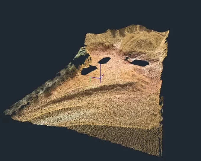
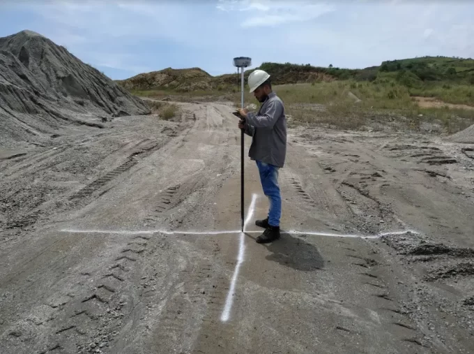
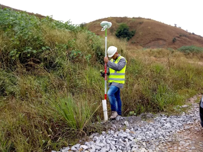
Control Points
After the initial parameters have been defined, the team must demarcate control points in the field using an RTK GPS. These points are materialized on the ground by means of targets placed strategically on the terrain. The size of the targets must be taken into account for their visualization on the aerial images during data processing.
Flight execution
Only after the demarcation of the targets in the field, along with the collection of coordinates of the control points with the GPS RTK, the flight with the drone is authorized. The take-off point is determined according to the access, prioritizing higher points of the terrain. The weather conditions on the date of the flight are also important for the imaging, and should be avoided rain, strong winds and too much sun to avoid many shadows in the images.
Data Processing
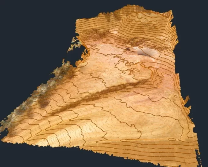
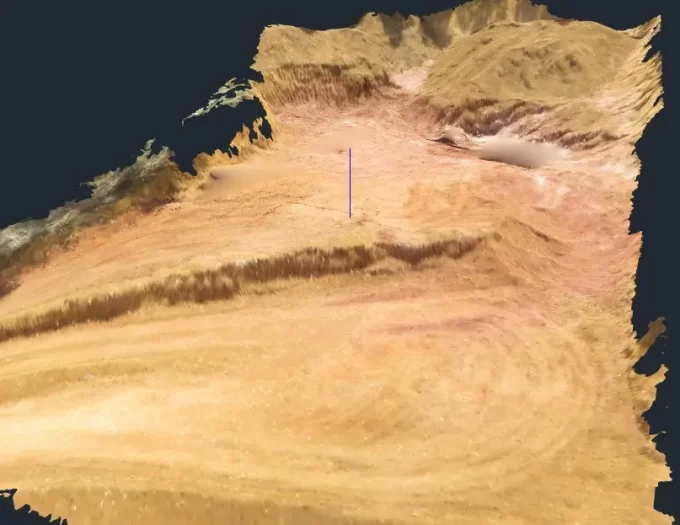
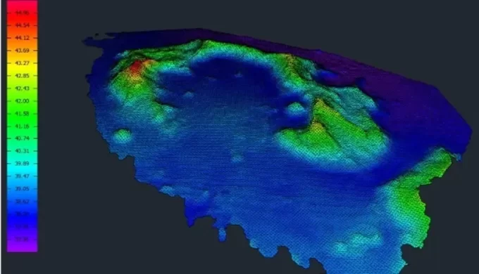
In this stage, the images obtained during the aerial survey, together with the geodetic GPS data, are processed by means of specific software, interpolating all the points in common obtained from the superposition of the images and reconstructing a 3D surface.
The final products generated are: georeferenced orthophoto mosaic, Digital Terrain Model (DTM), Dense Point Cloud, Land Use Map and Topographic Plan with auxiliary and master curves. These files can be assembled in Gis and Autocad software to improve the accuracy of the results.